

Google makes two of the most popular navigation apps: Waze and Google Maps. Waze is a more focused navigation app completely centered around the driving experience, placing a greater emphasis on crowdsourced incident reports. Google Maps, meanwhile, is the more versatile navigation platform. It has support for walking and cycling directions, immersive and live views, satellite maps, and detailed business and place cards. I've used both, and there's no question — Google Maps is the superior navigation app, and it's not particularly close.
Back in the day, Waze offered things Google Maps couldn't. While the Waze user base is much smaller than the Google Maps equivalent, Waze users are more engaged. They report incidents like road hazards or speed traps, and work together to provide real-time traffic and route updates. However, there's an important detail many Waze users completely forget about. Waze crowdsourced data and incident reports are integrated with Google Maps, so Maps users get many of the real-time updates of Waze while using the better navigation app.
Waze's core features aren't special anymore
Google Maps and Waze use the same dataset for incident reports


 Credit: Brady Snyder / MakeUseOf
 Credit: Brady Snyder / MakeUseOf
 Credit: Brady Snyder / MakeUseOf
 Credit: Brady Snyder / MakeUseOf
 Credit: Brady Snyder / MakeUseOf


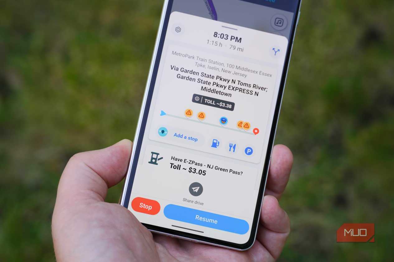
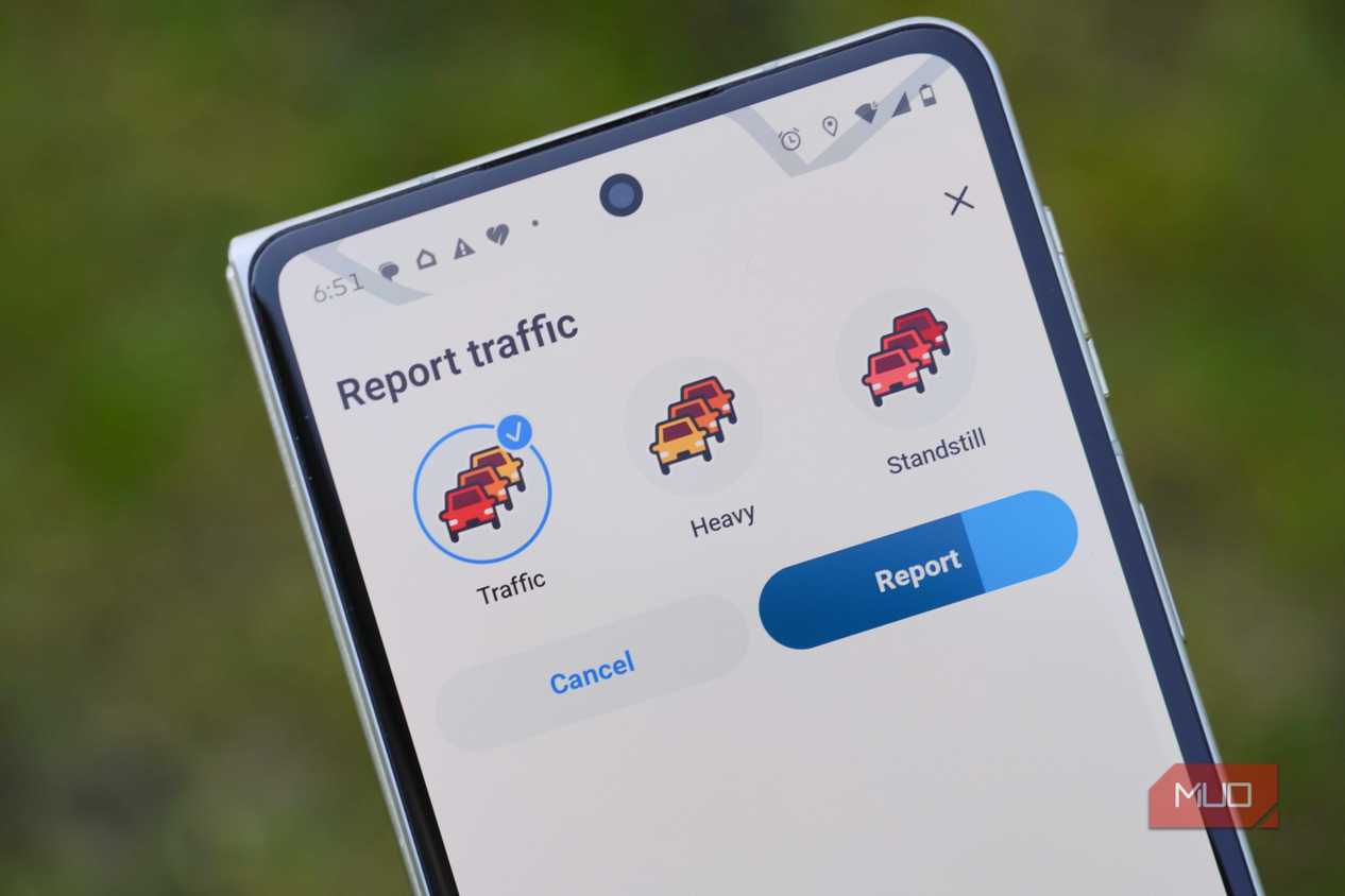
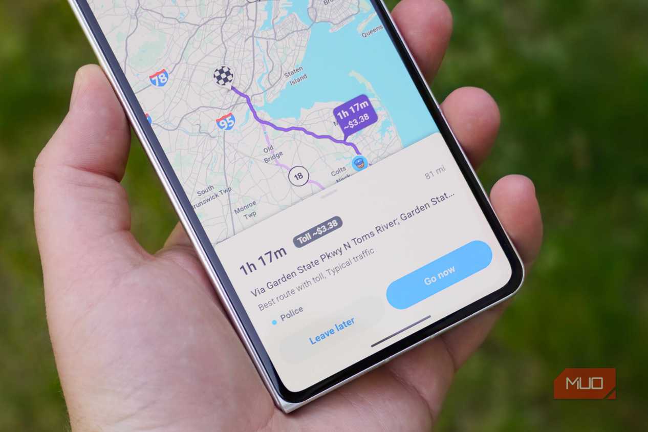
The key perk of using Waze is being part of an active community of users that crowdsource information about traffic, road conditions, weather, hazards, and police activity. Historically, Waze has offered better real-time updates than any other navigation app. It tells you about incidents like crashes or lane closures ahead of time, and provides a more detailed explanation of what's going on than an alternative app. Google Maps closed the gap in a major way in 2024, when Google overhauled the incident reporting UI and started pulling in Waze data.
Now, Google Maps users will see incident reports from both Maps and Waze users, covering topics like construction, lane closures, police presence, road objects, stalled vehicles, and crashes. Waze's best feature — crowdsourced incident reports — is no longer exclusive to the navigation app. You can switch to Google Maps today and get the same community-driven driving data as Waze, plus all the additional features offered in Maps. Name a Waze feature, and there's a good chance it's available in Google Maps as well.
The notable exception is the detail of incident reports across the two platforms. Google Maps will tell you if there's a camera ahead, but Waze will tell you exactly what that camera is watching. For instance, Waze can differentiate between cameras monitoring speed, red light violations, or HOV and bus lane violations. Google Maps provides basic reports and doesn't specify as much as Waze. Still, when I consider everything Google Maps has that Waze doesn't, the choice becomes easy.
Google Maps has more users, data, and features
With Waze, you're losing functionality for the sake of a cleaner interface

I could write thousands of words about the breadth of Google Maps' feature set, but I'll try to keep things concise. Waze is solely a driving app, and doesn't have support for walking, cycling, or public transit directions. This is a huge omission, and it's one I can't overlook. I frequently enter a destination in Google Maps, unsure of which mode of transportation I'll end up using. Based on the transit times provided by Maps, I'll make a choice. Sometimes it'll be to walk, other times it'll be to take the train, and in many cases it'll be to drive. Waze's lack of support for a variety of transportation modes makes it a non-starter for me.
Google Maps users benefit from extensive sharing of Waze data, but that information doesn't always flow both ways. Waze is sorely lacking in information about businesses, public places, and significant locations. When I pull up a coffee shop on Google Maps, I can see reviews and photos uploaded by real users. For popular places, I can search the hundreds or thousands of reviews to get the answer to a specific question I might have. Place cards in Waze are surprisingly barren — you might see a business' hours or parking availability, but not much else.

That's the difference between myself and hardcore Waze users. I understand that Waze users are focused on the driving experience and almost nothing else, but that's not how I use navigation apps. Services like Google Maps help me plan outings every step of the way, from using reviews and photos to pick a place, comparing transportation modes, and navigating my way there. A navigation app that only covers driving routes simply isn't meeting my needs.
Waze's limitations loom large when you think about the app's viewing options. Sure, there's no transit or pedestrian map views, but there also isn't support for immersive view, live view, or satellite view. These are essential features that navigation apps like Google Maps and Apple Maps have offered for what feels like forever, but Waze goes without them.
I'd never leave Google Maps for Waze
Google Maps does everything Waze does, and then some

Crowdsourced data is the backbone of navigation apps. This pooled information helps you get to your destination using the quickest route possible. Waze makes the critical mistake of only showing crowdsourced driving data. This information is also available in Google Maps, but Maps offers way more types of crowdsourced and curated information. User reviews, photos, and transit schedules are all kinds of crowdsourced or curated information that I find incredibly valuable, and they aren't available on Waze.
A decade ago, maybe I would've considered Waze. Now that Waze data is integrated with Google Maps, I see little reason to use the navigation app that's weaker in virtually every other aspect. I'm sticking with Google Maps, and I genuinely think Waze users don't know what they're missing.

- OS
- Android, iOS
- Developer
Google Maps is a web-based mapping service that provides detailed geographic information, imagery, and real-time navigation for driving, walking, cycling, and public transit.